Google’s Live Street View feature for Maps rocks.
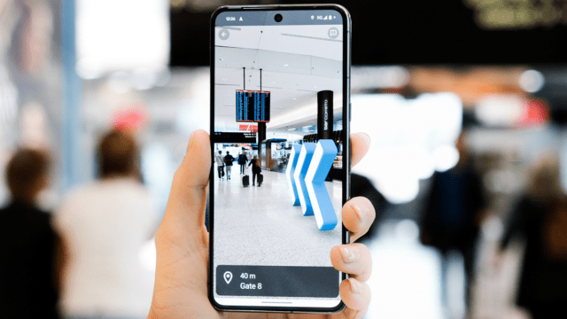
Using a smartphone camera and augmented reality technology, users are given directions to their destination through big arrows pointing them in the right direction – just start a walking trip, tap the ‘Live View’ button, raise your camera up and point it the right way, and you’ll see the way to go through indicative markers.
The technology really shines in difficult-to-navigate complexes – like airports, stadiums, and shopping centres (the name switches to ‘Indoor Live View’ in these places). When it was first brought to Google Maps, it was compatible with a number of Westfield Malls in the U.S., along with Zurich and Tokyo airports. In 2022, it was even rejigged to work at Marvel Stadium for when there’s a game on – to navigate you to your seats. You can think of it as an exceptionally cool shopping centre computer kiosk for finding your way around.
And now, Google has developed the tech for Sydney Airport – and it could be worth using, in case the domestic and international terminals are the same complicated hellscape for you as they are for me.
As demonstrated in the GIF above, all a user will need to do is tap where they want to go in the airport – it can be to a specific shop, the exit, the gate of your flight, baggage claim, or to the bathroom – directions are available to users as soon as you arrive at Sydney Airport, and can work from the nearby train stations (just make sure you tap the Live View button when beginning your walk).
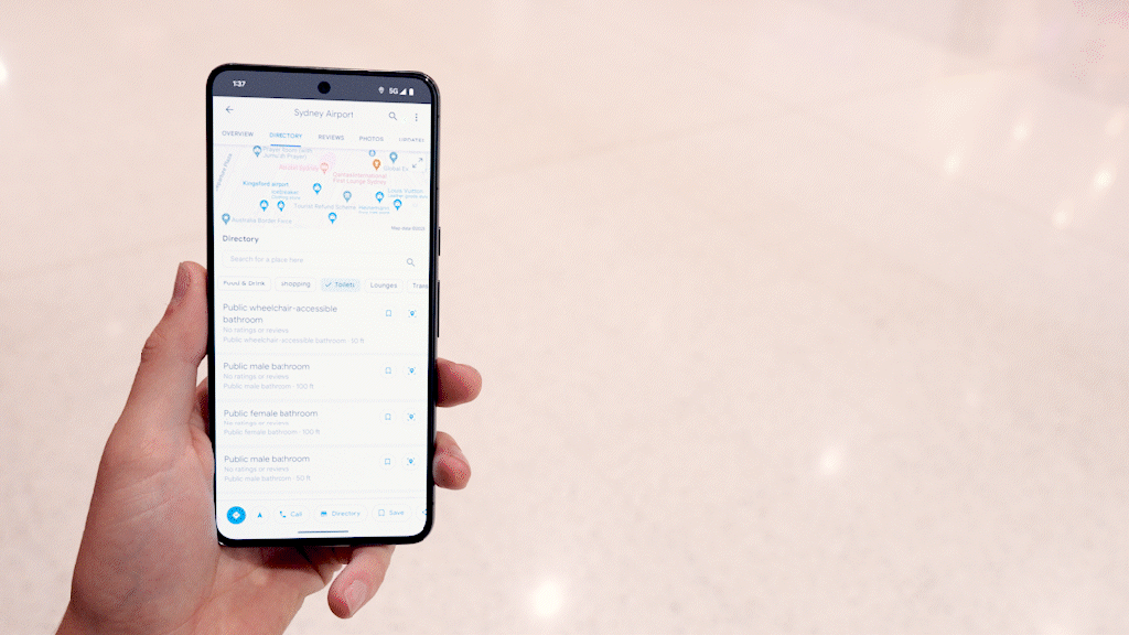
To find specific areas of the Sydney Airport that aren’t business, such as gates, you’ll need to type Sydney Airport into the search bar, and then tap the ‘Directory’ button – like in the below GIF. Additionally, users can tick boxes to get wheelchair or pram-accessible routes.

The feature has been developed using ‘global localisation’ – a technology “which uses AI to scan tens of billions of Street View images to understand your orientation,” according to Google. I’m getting the feeling Google likes AI.
Just be careful, because this kind of gimmick really drains your phone’s battery. It utilises its camera, GPS, gyroscope, and a hefty amount of its processing power, so don’t do it when you’re trying to save battery life.
Additionally, look, it’s not for everyone. Maybe a map on a notice board will suffice, but next time I’m at Sydney Airport, I’m going to give Google’s tech a go – it’s really cool. It’s now available on both Android and Apple phones.
Image: Google
While you’re here, why not check out our daily tech deals, our guide to the best value for money NBN plans, and info on the latest phones from Apple, Google, and Samsung. Head to our dedicated Mobile tab for more.
Leave a Reply
You must be logged in to post a comment.