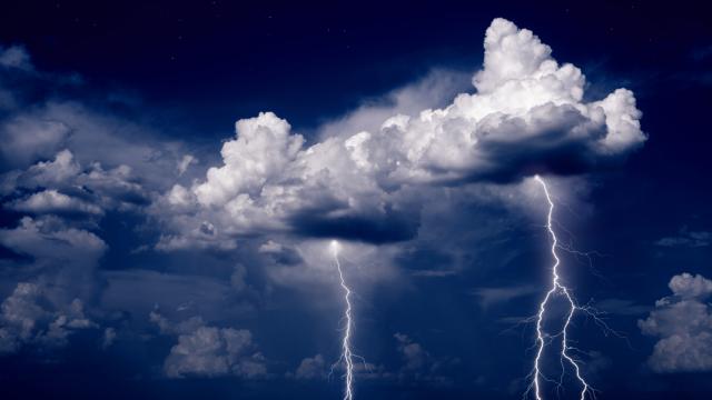
It is only mid-August, and several major tropical storms and hurricanes have already hit different parts of the United States. In fact, the country has already set a record for the highest number of named storms occurring by early August (nine). While there’s been some action in the usual spots in the southeast, the northern parts of the U.S. east coast have also been getting hit, including a visit from Hurricane Isaias (later downgraded to a tropical storm), which killed at least nine people, and left millions without electricity for days.
Then last week, large parts of the U.S. Midwest — including Iowa, Nebraska, Wisconsin, Michigan, Illinois and Indiana — experienced a collection of storms with hurricane-strength winds known as a “derecho” (more on that later). More than 200,000 people lost power, and four people lost their lives to the storm. With so many people (understandably) focused on the global pandemic happening right now, paying attention to the weather may not be a top priority. But if the past few weeks have been any indication, the strong storms will keep coming, and they don’t discriminate based on geography.
Before most weather events happen, people are typically given some warning in the form of emergency text alerts or notices on local news channels. And while the terms they contain are familiar — like “storm surge” or “hurricane watch” — people may not know exactly what they mean. For a quick lesson on storm terminology and concepts (including when we should really worry), Lifehacker spoke with U.S. National Oceanic and Atmospheric Association (NOAA) National Warning Coordination Meteorologist Chris Maier. Here’s what to know.
What’s the difference between a ‘watch’ and a ‘warning’?
When potentially dangerous weather is on its way, local reports typically include whether a particular area is under a “watch” or a “warning” for things like hurricanes, thunderstorms, flooding or high winds.
Watch
In short, Maier says that a watch is “a longer heads-up” before a particular type of weather hits. “A watch is based on how far out in time the hazard is expected to occur, and also how much confidence we, as the [U.S.] National Weather Service, have in forecasting the impacts of the event occurring,” he explains.
The timeframe of a watch depends on the type of weather hazard that’s approaching. For example, Maier says that a hurricane watch can go out several days in advance if meteorologist are relatively confident that it’s going to impact the coast. A tornado watch, on the other hand, typically is issued the day that it has the potential of occurring.
Warning
A warning, on the other hand, means that a weather hazard is imminent. According to Maier, when a warning is issued, it means that people should take action and get somewhere safe, if you haven’t already. Because every storm and its potential impact are different, Maier says that it’s important to pay attention to local weather reports and instructions from public officials and emergency managers to determine the best way to stay safe. “They’re the ones who are going to order an evacuation, and they’re going to do that only if they have to — if there’s a danger,” he explains.
But before it even gets to that point, Maier says that everyone should have a plan in place in the event of hazardous weather — especially during hurricane season if you live along the coast. This includes knowing your evacuation route, and what to do to your home and property to minimise the potential damage. “People should also know when to take action,” he says, “because if you wait too long and are stuck in the storm, it could become a life-threatening situation.”
How is it determined whether a strong storm involved a tornado?
A storm survey is how meteorologists determine what actually took place following major weather events that aren’t clearly hurricanes or tropical storms. After strong storms resulting in damage, experts visit the site of the storm to assess the damage and determine the type of rotation that caused it.
For example, “the strong winds that come out of a tornado just go straight outward — there’s no rotation to them,” Maier explains. “So trees will be knocked down in one direction, as opposed to seeing trees in a circular pattern.” This method — combined with radar data, input from local residents, and images and videos from social media — are ways to judge what caused damage if no one actually observed a tornado.
What is a derecho?
Maier describes a derecho — like the one that recently ripped through the Midwest — as a “wall of wind coming through a region of the country that can cause devastating power outages and other damage.” They are usually pretty rare, and it may only be evident that a derecho took place following a storm survey of the impacted areas.
What’s the difference between tropical depressions, tropical storms, and hurricanes?
Really, it comes down to the storm’s wind speed and escalating intensity, Maier explains. If there is a one-minute sustained average wind speed less than or equal to 60 kilometres-per-hour (km/h), it is considered a tropical depression. Tropical storms range from 62 to 117 km/h, and hurricanes feature sustained surface winds of 119 km/h or higher. From there, hurricanes are classified as different categories — again, based on wind speed.
What do the categories of hurricanes mean?
The Saffir-Simpson Hurricane Wind Scale places hurricanes in one of five categories based on its sustained wind speed and potential for property damage, with the numbers increasing with the hurricane’s severity. Category 1 hurricanes produce sustained wind speeds of 120-152 km/h, while those in Category 2 feature winds in the 154-177 km/h range.
Though Category 1 and 2 hurricanes are potentially dangerous, Maier says that those in Categories 3, 4 and 5 are considered major hurricanes and can cause significant damage. And when a major hurricane comes ashore, it could result in what’s called an “extreme wind warning,” which Maier says emphasises “incredible wind speeds that we’re going to experience that are going to cause damage.”
What’s a storm surge?
Typically, we hear about the potential for a storm surge when a tropical storm or hurricane is on its way. “The storm surge is basically the ocean flooding the coast above what you would normally see with the tide,” Maier explains. The extent of the storm surge at any given location depends on the orientation of the coast line with the track of the storm; the intensity, size, and speed of the storm; and the depth of the body of water relative to sea level, according to the U.S. National Ocean Service.
The flooding caused by a storm surge is often the greatest threat to life and property during major storms. Again, Maier stresses the importance of listening to messaging from local public officials. “They’re in a dangerous spot, basically, because any kind of storm surge is going to impact low-lying areas, and the last thing they want to do is have people not-evacuate when they could have,” he adds. Here is more information from the National Weather Service on preparing for a storm surge.
Why is flooding so dangerous?
Of all the aspects of strong storms, Maier stresses that flooding is one of the most dangerous parts. “The biggest thing to remember is that it only takes six inches of rushing water to knock you off your feet, and one foot of water will float most vehicles. If you get into two feet of flowing water, most vehicles will be pulled away,” he explains. Flooding also puts people at risk of drowning, especially, Maier says, when “they don’t understand the power of water.”
Leave a Reply
You must be logged in to post a comment.