If you woke up this morning thinking “holy hell it’s cold,” you are not alone, dear friends. The southeast of Australia has been smacked with a particularly chilly bout of weather after a polar outbreak turned up on Tuesday morning, News.com.au reports.
The effects of this outbreak have been felt most acutely by Victoria and Queensland, with snow hitting parts of VIC and Northern Queensland facing heavy rainfall to the point of placing the region on flood watch.
In terms of temperature drops specifically, Victoria and Tasmania will face the most extreme shifts with both states forecast to see lows under the 10 degrees mark across the week.
Wednesday is set to be a particularly icy one with temperatures forecast to sit at a low of 4 degrees and a max of 15 in Tasmania. Melbourne is expected to see a low of 9 degrees and a high of 15 degrees, so bust out your beanies, pals. The Bureau of Meteorology Australia estimates Victoria will see its coldest night of the year overnight.
Rug up #Victoria. Temps will plummet tonight, with many locations to have their coldest night of the year so far. A Frost Warning has been issued for the #Mallee and #Wimmera districts. Check the forecast: https://t.co/HMRu5AMU8p #VicWeather pic.twitter.com/ZxmAGZ2Rzg
— Bureau of Meteorology, Victoria (@BOM_Vic) April 20, 2021
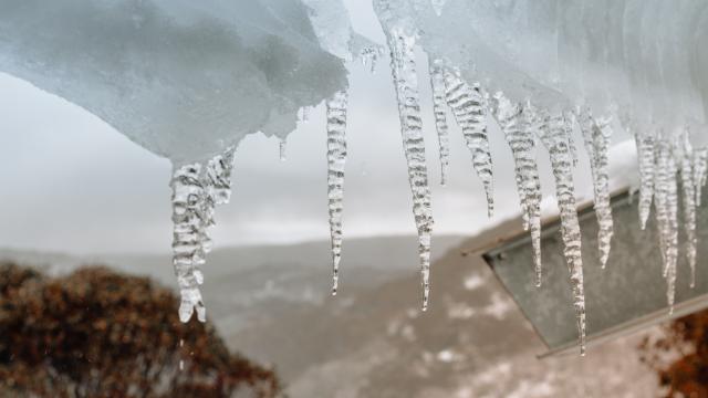
According to reports from News Corp, parts of Tassie have gotten so cold that the “feels like” temperature has reached the negatives. Temperatures got to 1.9C and 2.8C in Mount Hotham and Falls Creek but felt like -7.2C and -6.2C. (Holy heck.)
Time to switch over to the winter doona with frosty mornings on the forecast for southeast Australia and more wintery weather on the way. A series of cold fronts forecast to bring strong winds, showers, possible hail & snow to elevated areas this week. https://t.co/f03ErweBvZ pic.twitter.com/zonf00aTsE
— Bureau of Meteorology, Australia (@BOM_au) April 18, 2021
Weather warnings have been issued in a number of areas across Australia
A number of weather warnings are currently in place across Victoria. Frost Warnings have been issued in advance of the cool temperatures expected on Wednesday morning for the districts of Mallee and Wimmera.
Mt Buller, Falls Creek and Mt Hotham have been warned of damaging winds “averaging 50 to 70 km/h with peak gusts of around 90 to 100 km/h” over Alpine areas across Tuesday. Safety advice available here.
And a road weather alert has been issued for the city of Melbourne, with heavy rain leading to slippery roads and reduced visibility.
Tasmania has also been issued a weather warning regarding increased frost, and bushwalkers have been alerted of expected snow in the Western and Central Plateau districts.
The arrival of this particularly gnarly weather is in part due to our shift towards the cooler months, sure. But as Sarah Scully of the Australian Bureau of Meteorology recently shared, the cold front we are experiencing is unusually biting. Read more about her thoughts on Australia’s weather here.
Until then, pop on the kettle and get out the uggs. It’s going to be cold for a while yet.
Leave a Reply
You must be logged in to post a comment.