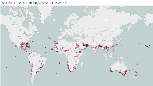
If you’re not sure exactly where you want to go on your next holiday, or you know where but are flexible on when you go, this interactive map uses 10+ years of National Oceanic and Atmospheric Administration (NOAA) data to show you what the weather will be like. This first step in travel planning makes sure you’ll have good weather for your trip.
Image from decisiondata.
Though the original map was in Fahrenheit, creator Ryan Whitacker has since built a Celsius version.
This data comes from buoys, so the locations may not be exactly where you want to travel, but you can get a regional idea of what the weather will be like at your destination. Once you find an area you’re interested in visiting, you can check for more specific weather predictions that take into account the time of the year. For example, I’m taking a trip to the UK this spring and I’d like to visit a few other countries while I’m there. This map showed me what the weather is likely to be like in countries near the UK so that I can decide which ones to add to my trip.
Weather is a big factor to consider when planning a trip, but it isn’t the only one. When deciding where to travel next, you should also do research on local holidays that could affect what’s open, as well as activities you want to add to your “must do” list. Also keep in mind your budget and how much time you have for your holiday.
Comments
One response to “Before You Plan A Holiday, Check The Weather With This Handy Map ”