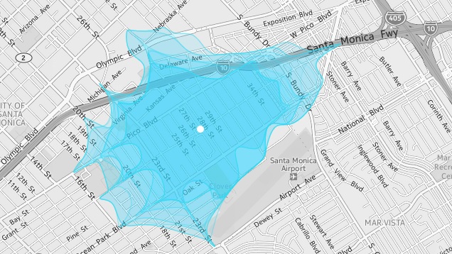
If you’re curious about the traffic congestion in a given area, web site Isoscope shows you how far you can get from any location in 10 minutes.
Once you open the web site, you can enter any city you like and its map will appear. Click anywhere on the map and you’ll see a blue blob appear that shows you how far you can reach in a given amount of time. You can adjust the day of the week, time of day, whether you’re walking or driving, and your travel time from 2 minutes to 10 minutes.
It can only visualise up to 10 minutes, which is an annoyingly small amount of time, but it might come in handy if you’re not familiar with an area or if you’re trying to time out your daily commute. Hit the link to check it out.
Isoscope [Flavio Gortana via Fast Coexist]
Comments
4 responses to “Isoscope Shows How Far You Can Drive In 10 Minutes From Where You Are”
It’s cool but it seems to be highly inaccurate in it’s current form. I looked up where I live and what it said would take me 2 minutes to drive, I know takes about 20 seconds.
It worked fine for me :).
I don’t care where I go, I just wanna be 10 minutes from where I am right now…
As you visualise larger amounts of time, you have to take into account an exponential increase in places you could possibly be. Some smart algorithm work could trim that down, but it’s still a huge amount of work compared to just finding directions.