iOS/Android: If you’ve ever flown and wondered what exactly you were flying over or past, Flyover Country is an app that helps you figure it out. It provides helpful information on landmarks and other sites, identifies them and shares a little history, too.
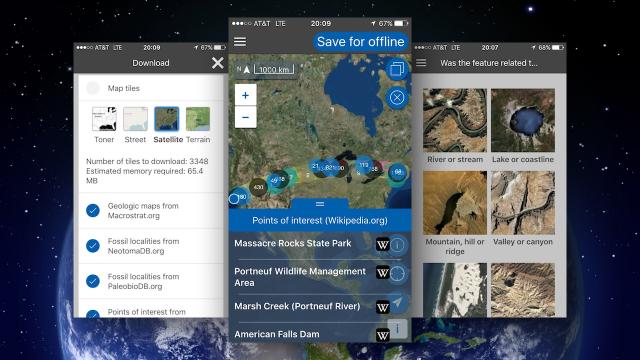
When you’re gazing out the plane window, you often see cool landmarks, mountains or other features, but unless you have (or spring for) inflight Wi-Fi, you can’t Google what you’re seeing. In Flyover Country, just enter your flight and it will offer you a map you can save for offline use during your flight, or to dig up what you passed while you were in the air. Depending on what you want to learn about, you can choose between geological maps, locations of fossils and Wikipedia articles. You can view the map with satellite imagery, street views or terrain. You can also use Flyover Country to learn more about landmarks and other points of interest during hikes and outdoor excursions.
Flyover Country [University of Minnesota]
Flyover Country (Free) [iTunes Store]
Flyover Country (Free) [Google Play Store]
Comments
One response to “Flyover Country Tells You All About The Places You See When You Fly”
HAH! I totally had this idea 2 years ago! Glad to see someone actually made it so that I didn’t have to.