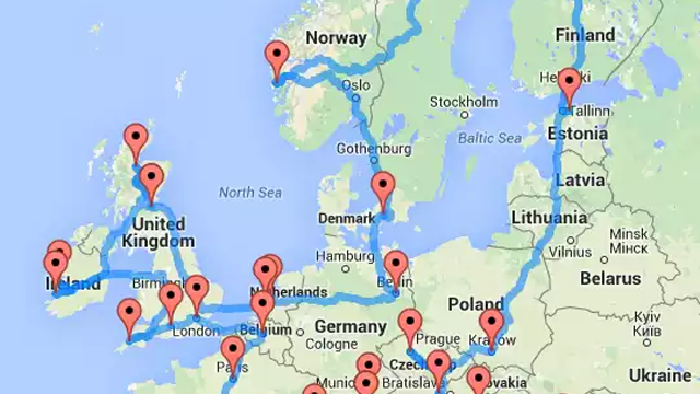
Forty-five European cities, 14 days of driving and several months of sightseeing: That’s the optimised plan created by an algorithm, a followup to the data-driven perfect US road trip we saw earlier this month. Randal Olson used the same drive-time-minimising algorithm to compute this road trip, but based the cities on Business Insider’s selection of 50 must-see places in Europe.
Olson notes that Eastern Europe is underrepresented in the road trip, but you could add stops between Poland and Estonia.
Here’s the map. There’s an interactive version as well.
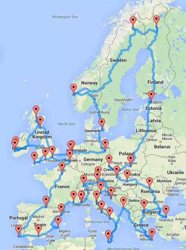
Of course, the selection of these stops is completely subjective, but the great thing is Olson offers the Python code used for this project and the instructions for how to customise your road trip in case you disagree with the cities selected here.
Computing the optimal road trip across Europe [Randal S. Olson via Road Warrior Voices]
Comments
2 responses to “This Map Shows How To Take An Epic Road Trip Across Europe”
I used http://www.gebweb.net/optimap/ when I was planning my trip around Europe. You just list the places you want to see, select return trip or one way and it will work it out.
I wonder if they get the same results?
When I was using mapping software pre-Google maps, there were often mistakes that nearly diverted me off more interesting routes. For instance this map of a 20000km journey I did over three months was constructed on the basis that you couldn’t drive directly through Finland to the top of Norway or through the Tatra mountains between Slovakia and Poland.
http://4.bp.blogspot.com/_rxWIlOrO5WE/Rd8v7f71fdI/AAAAAAAACwU/sUhLhvMNPek/s400/Europe+2a.gif
My actual driving route was about 85% faithful to this route, so I got in a lot of Finland, most of the Norwegian coastline, and took the ferry from south of Copenhagen to Germany. Driving through Denmark is exceedingly boring (and expensive with bridge tolls).